Lake Xochimilco: Does It Still Exist, and What Is Left of It?
People arrive expecting a lake and find a grid of water lanes between farm plots. Both are correct: the canals are what is left of the lake, and they are still working.
Short answer
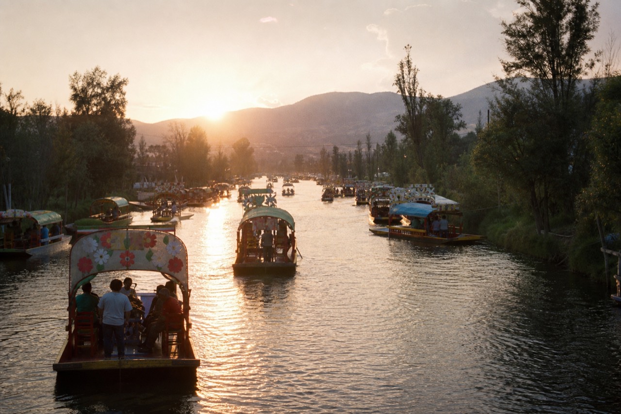
Yes, in the sense that matters. The open sheet of water is gone, but roughly 170 kilometres of canals survive inside a protected natural area of about 2,500 hectares, fed by springs and treated water and still farmed from the banks. UNESCO inscribed the zone in 1987 as part of the Historic Centre of Mexico City and Xochimilco.
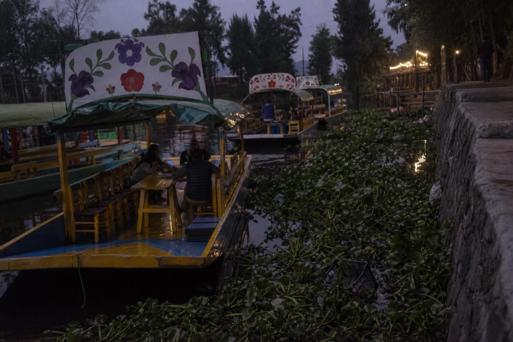
Push out of Cuemanco early enough and you can hear the difference before you see it. The tourist canals sound like a street fair: speakers, pole-splash, somebody's cumbia colliding with somebody else's mariachi. Twenty minutes further south the noise drops off a cliff. Coots pick through the water hyacinth, a farmer stands on a bank loading crates of lettuce onto a flat boat, and the water opens out into something that finally looks like the word lake. That is the part almost no visitor sees, and it is the part that explains everything about why this place is protected.
Does Lake Xochimilco still exist?
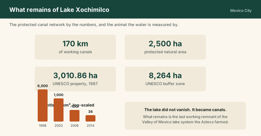
Yes, as a canal system rather than an open lake. Around 170 kilometres of waterways survive inside a protected natural area of roughly 2,500 hectares, with the World Heritage property itself covering 3,010.86 hectares plus an 8,264 hectare buffer. The broad sheet of water is gone. The water lanes, the farm islands and the farming are not.
The confusion is a translation problem as much as a geographical one. Lago de Xochimilco names a body of water that was one of a chain filling the floor of the Valley of Mexico, shallow, marshy in places, brackish in others. What remains is not a smaller version of that lake. It is the network of channels that ran between the farm plots built into it, plus a few open lagoons where the channels widen out.
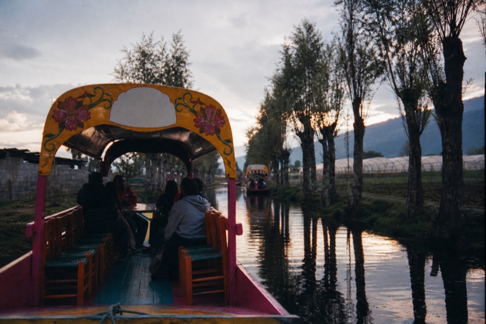
So if you arrive expecting to sail across something, you will be disappointed for about four minutes and then you will stop caring. The canals are the point. They are narrow enough that you pass within a metre of somebody's greenhouse, wide enough for two boats to pass, and they go on for so long that no visitor sees more than a fraction of them in an afternoon.
There is a second thing worth being clear about. This is a working landscape, not a preserved ruin. People live on the chinampas, grow on them, sell from them, and move around by boat because in parts of the zone there is no other way. That is the difference between Xochimilco and a heritage site behind glass.
What happened to the lakes of the Valley of Mexico?
The valley floor once held a connected chain of shallow lakes, and Xochimilco sat at the southern, fresher end of it. Centuries of drainage engineering, then twentieth-century urban growth and groundwater extraction, reduced the system to fragments. Xochimilco survived better than the rest because its chinampa farmers had every reason to keep the water where it was.
The chinampa system is old. Archaeological work dates the technique to around 1100 CE, with the earliest firmly dated examples in the Middle Postclassic period, roughly 1150 to 1350, built by Nahua communities in the shallow lakes of the southern basin. Under the Aztecs the system expanded enormously, feeding Tenochtitlan from a landscape that was half farm and half water.
| Period | What was happening in the water |
|---|---|
| Around 1100 CE | Chinampa building begins in the shallow southern lakes |
| Roughly 1150 to 1350 CE | Earliest securely dated chinampas, in the Xochimilco and Chalco system |
| Aztec era | Large-scale expansion; the lacustrine landscape feeds Tenochtitlan |
| Colonial period onward | Drainage engineering begins to pull water out of the basin |
| Twentieth century | Urban growth and groundwater extraction shrink what is left; springs are tapped for the city |
| 1987 | UNESCO inscribes the zone as part of the Historic Centre of Mexico City and Xochimilco |
| 1998 to 2014 | Published axolotl surveys record a collapse from 6,000 to 36 individuals per square kilometre |
| 2025 to 2026 | A new UNAM-led population survey runs; restoration and invasive-species work continues |
I am deliberately not giving you a tidy list of drainage dates, because the honest version is messier: the basin was being drained, refilled, flooded and drained again over several centuries by different authorities with different plans. What is not in dispute is the direction of travel. Water left, the city arrived, and the southern canals ended up as the last substantial piece of the old system still doing what it originally did.
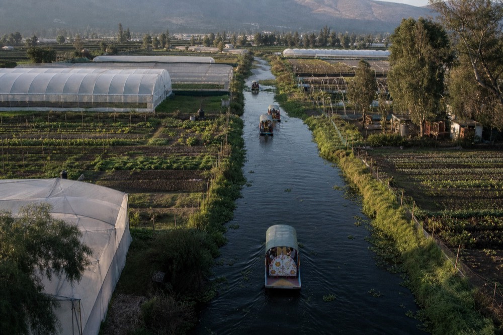
The reason Xochimilco held on is not sentiment. It is that thousands of families made their living from the chinampas, and a chinampa without a canal beside it is just a field with bad access and no irrigation. The farming defended the water, and it is still doing so. That relationship is the whole subject of how the chinampa plots are built.
How big is the canal system today, and what is protected?
Roughly 170 kilometres of canals remain, inside a protected natural area of about 2,500 hectares. The UNESCO property covers 3,010.86 hectares with an 8,264 hectare buffer zone, inscribed in 1987 under criteria ii, iii, iv and v as part of the Historic Centre of Mexico City and Xochimilco.
Numbers help here, because "the canals" sounds like a couple of picturesque channels behind a car park and it is nothing of the sort.
| What | Figure |
|---|---|
| Canal network remaining | About 170 km |
| Protected natural area | Around 2,500 hectares |
| UNESCO property | 3,010.86 hectares |
| UNESCO buffer zone | 8,264 hectares |
| Year inscribed | 1987 |
| Criteria | ii, iii, iv, v |
| Dock operating hours | 8:00 to 18:00 |
A hundred and seventy kilometres is more water than you can process from a boat seat. For scale, a standard tourist circuit out of the main docks covers a loop you could walk in an afternoon if it were dry land. Everything else is out there: farm canals, service channels, lagoons, dead ends behind somebody's nursery, stretches where the only traffic is a farmer moving soil.
The protection regime is layered rather than absolute, which is why you will see a restored dock and a fly-tipped bank within the same kilometre. The inscription covers the zone as a cultural landscape, and the UNESCO listing itself is explicit that Xochimilco is recognised alongside the historic city centre rather than as a standalone natural site. That framing matters: what is being protected is the combination of water, farm plots and the practices that keep them going.
Why is Xochimilco a UNESCO World Heritage site?
Because it is the last working piece of a farming system that fed a pre-Hispanic capital, still using the same techniques on the same ground. The 1987 inscription covers criteria ii, iii, iv and v, recognising the exchange of human values, a cultural tradition, a landscape type, and a way of life vulnerable to change.
The four criteria are dry on paper and quite specific in practice. Criterion v is the one that reads truest here: it is used for landscapes representing a traditional human settlement or land use that has become vulnerable. That is Xochimilco exactly. The canals are not vulnerable because someone might knock them down. They are vulnerable because the economics of farming a small island by boat are hard, because the city presses against the boundary, and because water tables fall.
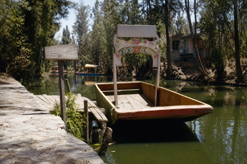
What the status has not done is freeze the place in amber. World Heritage listing brought attention, funding streams and an obligation to report, and it sits alongside the federal and city-level protected-area designations. The borough has kept investing in the visitor side too: 174 million pesos went into embarcadero upgrades in the run-up to the 2026 World Cup, and those works are finished. If you want to know which dock got what, the dock-by-dock rundown has it.
For the visitor, the practical consequence of the listing is subtle but real: the parts of the zone that feel most protected are the parts you have to make an effort to reach. That is not a coincidence.
How clean is the water in the Xochimilco canals?
Not clean. Water quality across the network remains poor, with treated wastewater making up much of the supply and invasive tilapia and carp dominating the fish population. It is safe to be on and not safe to be in. Restoration projects are working canal by canal rather than system-wide, and results are local.
I want to be straight about this, because a lot of travel writing about Xochimilco skips it. The water is green-brown, it carries a smell in the heat, and the ecological pressure on it is serious. The two headline problems are chemistry and biology. Treated and partly treated water sustains the level, and introduced tilapia and carp eat the eggs and larvae of the native species, which is the single biggest reason the axolotl population fell off a cliff.
| Pressure | What it does | What is being done |
|---|---|---|
| Poor water quality | Low oxygen, high nutrient load, unsuitable for sensitive native species | Filtration projects on individual chinampas, wetland-style treatment beds |
| Invasive tilapia and carp | Predation on native eggs and larvae; competition for food | Removal programmes and physically separated refuge canals |
| Urban pressure at the edges | Encroachment, waste, altered drainage | Protected-area enforcement, buffer-zone management |
| Falling groundwater and spring loss | Less natural inflow, dependence on treated supply | Recharge and restoration work, still small in scale relative to the system |
| Abandoned chinampas | Banks collapse without maintenance, canals silt up | Programmes bringing plots back into cultivation |
The most interesting response, and the one you can actually visit, is the refuge chinampa idea: a single plot's surrounding canal separated with biofilters so the water inside can be cleaned and kept free of introduced fish, creating a pocket where native species can survive. It is small, it is slow, and it works. Reporting through 2025 and into 2026 has tracked these projects alongside continued invasive-species control.
So: no swimming. Not as a matter of squeamishness, as a matter of both public health and the ecosystem. The reasons are laid out properly in why swimming is off the table.
What actually lives in the canals now?
Water birds, plenty of them, plus introduced fish that dominate the water column and a native amphibian that has almost disappeared from it. The wild axolotl density fell from 6,000 per square kilometre in 1998 to 36 in the last published survey in 2014. From a boat you will see herons, egrets, coots and ducks, and no axolotls.
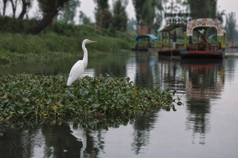
Birds are the thing nobody mentions and everybody photographs. Herons stand on the chinampa edges with the patience of statues, egrets lift off ahead of the boat, coots work the hyacinth mats, and in the winter months migratory ducks turn up in the open lagoons. On a quiet morning run in the ecological zone you can count a dozen species without trying.
The axolotl is the animal everyone asks about and nobody sees. The published density series is brutal, and I will not soften it: a drop of that scale over sixteen years is not a fluctuation. Conservation groups now describe the wild population as being on the brink, and the conservation reporting on the species explains why captive breeding alone does not fix a habitat problem. A new UNAM-led survey has been running since around 2025 and its results were still pending as of this summer.
What that means for your day: the only reliable way to see one is a sanctuary or ajolotario stop, where captive-bred animals are kept in tanks for research and education. Any trip promising a wild sighting from the boat rail is selling you something it cannot deliver. The full picture, including which trips include a sanctuary, is in where the axolotls actually are.
Which parts of the lake can you actually reach by boat?
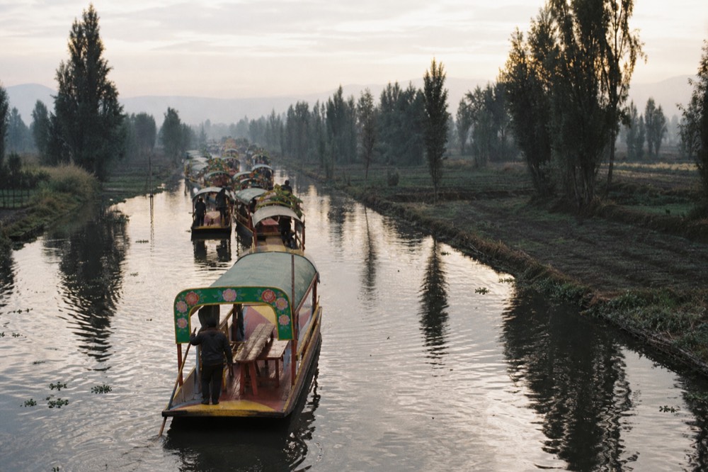
Three zones, in rising order of quiet. The main tourist canals out of Nativitas and Las Flores, the calmer ecological stretch around Cuemanco, and the working farm canals and lagoons beyond, including Teshuilo and the Apatlaco side. Most visitors only ever see the first, and it is the least representative of the three.
| Zone | Character | Typical access | Boat time from the docks |
|---|---|---|---|
| Main tourist canals | Vendor boats, mariachi, boats rafted together at weekends | Nativitas, Las Flores, most shared trips | Immediate |
| Ecological zone around Cuemanco | Quieter water, bird life, park landings, La Llorona venue | Cuemanco, small-group and eco trips | 10 to 30 minutes |
| Working farm canals and lagoons | Chinampas under cultivation, cargo boats, open lagoons, almost no tourists | Private charters, chinampa and sunrise trips | 45 minutes and up |
The gap between zone one and zone three is enormous, and it is the single most useful thing to understand before booking anything. Zone one is a party on water and genuinely fun, which is why the biggest boats sell the most seats. Zone three is where the World Heritage designation makes sense, and reaching it costs either time, money or both.
The far end of the network is also where the original doll island sits, out in Laguna del Teshuilo, which gives you a sense of distance: that trip runs about an hour and a half to two hours each way.
Which trips get you into the quiet water?
The ones that leave early, cap the group, or run private. The pre-Hispanic chinampa trip with a sanctuary stop runs 5 to 6 hours and rates 5.0 from 46 reviews. The sunrise trip runs 5 hours and rates 5.0 from 123. The private trajinera runs 4 to 5 hours at 4.9 from 25. All three carry free cancellation up to 24 hours.
| Trip | Duration | Rating | Reviews | Free cancellation | From |
|---|---|---|---|---|---|
| Pre-Hispanic Xochimilco: Chinampa Lunch and Axolotl Sanctuary | 5 to 6 hours | 5.0 | 46 | Yes, 24 hours | $216 |
| Xochimilco at Sunrise with Breakfast and Transport | 5 hours | 5.0 | 123 | Yes, 24 hours | $174 |
| Private Trajinera Through the Canals, Transport Included | 4 to 5 hours | 4.9 | 25 | Yes, 24 hours | $108 |
Those are from-prices and the live listing is the authority on what any given date costs. The pattern is clear enough: quiet costs more, mostly because you are paying for hours rather than seats, and often for transport from your hotel rather than a dock meeting point.
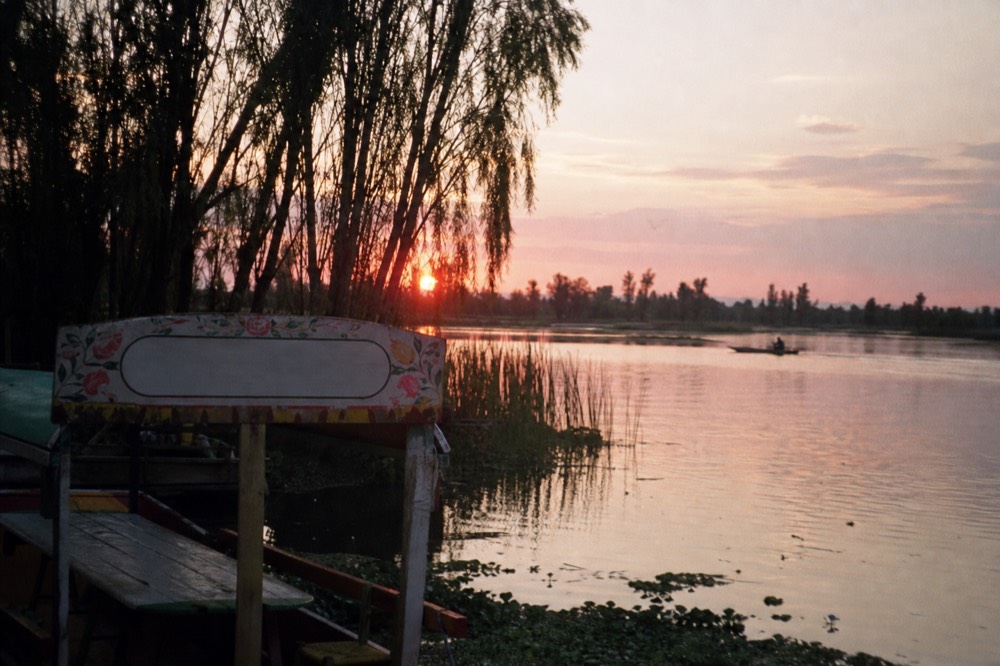
If your priority is the landscape rather than the day out, the sunrise option does something no other format can: it puts you on the water before the vendor boats launch, when the mist is still on the lagoons and the birds are working. Compare the timings across the private and eco trips, or check which mornings are open before you fix a date, because the early departures fill first.
Doing it yourself is entirely possible and cheaper. The official tariff is 750 MXN per hour per boat, posted capacity limits run 18 to 20 people, and the docks run 8:00 to 18:00. Four hours of boat to reach the quiet water and come back is 3,000 pesos split across your group. What you give up is the guide, the sanctuary access and any chance of a chinampa lunch, since those are arranged relationships rather than things you can turn up and buy.
What is being done to bring the lake back?
Habitat restoration on a plot-by-plot basis, invasive fish control, and a research effort centred on UNAM and the CIBAC centre at Cuemanco. Nobody is proposing to refill the valley. The realistic goal is more canals with clean enough water and enough native species to hold, which is being achieved one chinampa at a time.
| Effort | What it is | Where you can see it |
|---|---|---|
| Refuge chinampas | Individual plots with biofilter-separated canals, kept free of tilapia and carp | Chinampa and eco trips that include a farm landing |
| CIBAC, Cuemanco | Research centre working on axolotl breeding and canal biology | Sanctuary and ajolotario stops on longer trips |
| UNAM research programmes | Population surveys and habitat work led from the university | Public outreach and adoption campaigns rather than on-site visits |
| Adopt an Axolotl | Fundraising and education campaign run through the university foundation | Online, supporting the tank and refuge work |
| Chinampa recovery | Bringing abandoned plots back into organic cultivation | Working farms visited on the longer canal trips |
| Invasive species removal | Netting and removal of tilapia and carp from target canals | Occasionally visible from the water in the ecological zone |
There is a version of this story that is purely bleak, and it is not the accurate one. The system is under real pressure and the axolotl numbers are frightening. At the same time, farmers are returning to abandoned plots, restaurants in the city are buying chinampa produce, and there is enough demand for canal-grown vegetables that the economics have shifted a little in the right direction. Reporting through 2025 and 2026 has covered both sides honestly.
Which brings me to the visitor's part in it, and I will keep this short because nobody wants a lecture on holiday. Money spent on the quiet end of the canals goes to farmers and cooperatives who maintain banks and canals. Money spent in the party stretch mostly goes to boat owners and vendors, who also need it. Both are legitimate. But if you have been told the canals are dying and you want to do something about it, the useful move is to buy a day out on a working chinampa rather than to feel bad about the trajinera. The trip built around exactly that, farm lunch and sanctuary stop included, lets you check the available dates before you plan the rest of the week. For the full lineup and what each format actually delivers, the front page lays out the whole canal tour lineup side by side, and what to pack and which day to pick handles the practicalities. If you are still deciding whether any of this is your kind of day, what draws people here is the honest version.
Does Lake Xochimilco still exist?
Yes, as a canal system. The open lake is gone, but roughly 170 kilometres of waterways survive inside a protected natural area of about 2,500 hectares, still farmed from the banks and still used for transport. UNESCO inscribed the zone in 1987 as part of the Historic Centre of Mexico City and Xochimilco.
Why is Xochimilco a UNESCO World Heritage site?
It was inscribed in 1987 under criteria ii, iii, iv and v as part of the Historic Centre of Mexico City and Xochimilco. The listing recognises a pre-Hispanic farming landscape of artificial islands and canals that is still worked today, and flags it as a traditional land use vulnerable to urban and environmental change.
Is the water in the Xochimilco canals clean?
No. Water quality is poor across most of the network, sustained largely by treated wastewater, with invasive tilapia and carp dominating the fish population. It is fine to be on in a boat and unsafe to swim in. Restoration works canal by canal, using biofilter-separated refuge plots rather than treating the whole system.
How deep are the canals?
Shallow. Trajineras are flat-bottomed and are pushed along with a long pole rather than rowed or motored, which only works in water measured in a couple of metres at most, and considerably less in the farm channels. That shallowness is why the boats are stable and why the poling technique has not changed in centuries.
Can you see the whole canal network in one trip?
Not remotely. With about 170 kilometres of canals, a standard two-hour circuit covers a small loop near the departure dock. Reaching the working farm canals and the far lagoons takes four hours or more, which is why the longer private and chinampa trips exist and why they cost what they do.